by Wanda
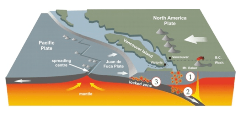
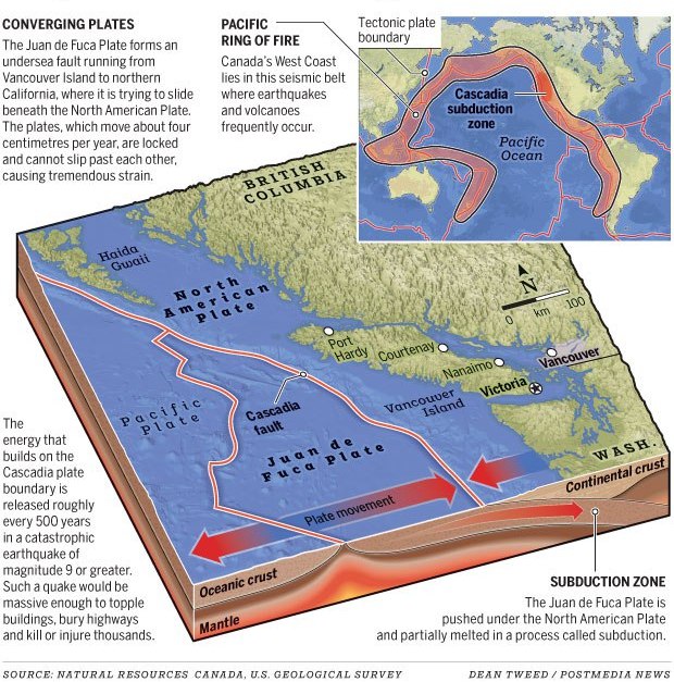
The Juan de Fuca plate meets up with the North American Plate off the west coast of Vancouver Island and they are pushing against one another along the Cascadia fault line creating a subduction zone under BC’s west coast. This fault runs parallel to the island and is one of the most active in Canada.
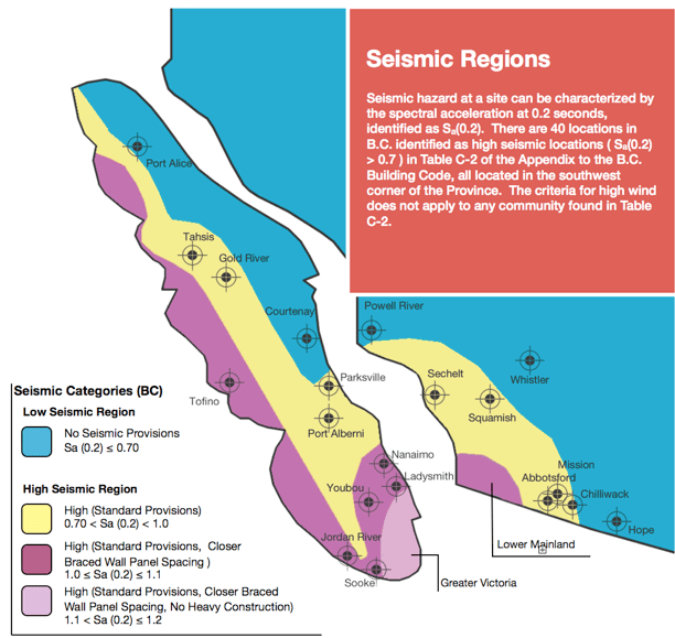
Because this creates an elevated risk of earthquakes on the island new building codes have been implemented. Chemainus is closer to the southern tip of the island and is in the second highest seismic risk zone.
As of December 2014 these new codes have been deemed mandatory on all new builds and will have an impact on our new home. Below are a few graphics along with information links about the new codes.


When earthquakes occur underwater there is always a risk of tsunami. The graphic below shows the tsunami risk zones on the island. Chemainus is in a lower risk zone.
Links:
Earthquakes Canada Great information and links published by Canadian Federal Government. Historical Data can also be found here.
Overview of New Requirements Plenty of graphics and code descriptions in easy to understand laymen’s terms
BC Earthquake Fact Sheet Excellent fact sheet and links
Links to new building code information.
2014 Amendments to the Building Code
BC Building Code and Earthquake Safety
